This one may be the straw on the camel's back. Started about midnight here. Following accumulation is from local PWS KTXCLEVE8 about 6 miles from me--since 1:30am local. 64.9 °F Feels Like 64.9 °F 4.0 mph Wind from ENE Gusts 4.9 mph Dew Point: 57 °F Humidity: 76% Precip Rate: 1.49 in/hr Precip Accum: 8.76 in Pressure: 29.73 in
Daylight may show me something I really don't want to see.
from NWS: at 432 am CDT... Doppler radar and automated rain gauges indicated thunderstorms producing heavy rain across the warned area. 4 to 7 inches of rain have fallen with areas of 6 to 16 inches of rainfall. Flash flooding is on going.
Hopefully we can get a 12-20 hr break of light rain or no rain so this local stuff can run off down river---before all the water from up river water shed makes it down here.
Don't you know you are now the 1% as far as rainfall? Don't be selfish. You should be collecting all that rain in buckets and shipping to the drought-ridden sections of the Southwest. All that shipping should be out of your pocket of course. I joke, but seriously, I hope you come out of it with nothing more than musty smell.
For the first time ever, we're trapped on our own property. 3 ways out and all 3 are under @ least a foot of running water and I have no way of knowing the condition of the grade below the water. Rain has slacked off some, so maybe later we can get to town in the truck and get some milk, bread, and sandwich stuff in case the power goes out too. We been up all night, and think we'll just go to bed and pretend I'm 50 and she's 35 again.
For the first time ever, we're trapped on our own property. 3 ways out and all 3 are under @ least a foot of running water and I have no way of knowing the condition of the grade below the water. Rain has slacked off some, so maybe later we can get to town in the truck and get some milk, bread, and sandwich stuff in case the power goes out too. We been up all night, and think we'll just go to bed and pretend I'm 50 and she's 35 again.
You old pervert you !
I think you should take the boat to town, ether that or buy a set of chest waders. But I agree do not try to cross the river of doom to the road unless you have a snorkel on that pickup of yours. Steve
------------------ Technology is great when it works, and one big pain in the ass when it doesn't
Detroit iron rules all the rest are just toys.
[This message has been edited by 84fiero123 (edited 04-18-2016).]
I think you should take the boat to town, ether that or buy a set of chest waders. But I agree do not try to cross the river of doom to the road unless you have a snorkel on that pickup of yours. Steve
From the radar images around his place, chest waders would turn into anchors.
That gage is about 500 yards from the 'Worst Eastern' motel we are currently stayin in, and that gage's reading is misleading in reference to my own location appox 9 miles upstream. There are 3 types of flooding I risk here--one is from the river stage, like last month's flood and that is caused by water from upstream several counties to the North. That March flood took place here under clear sunny skies. The 2nd type flood (and today's flood water) is caused by out flow from the National Forest on to my property caused by local heavy rains. Today, and as of right now, the river is not a problem, but since the northern counties got the same wx system we did, that will all change in the next 12-24 hrs as the watershed from those counties will be in my pasture soon enough.
We got a break from the rain for most of today, and it still isn't raining here, so we were able to get off the property about 1 pm in the truck and Jane's car tho we had to leave the Dart on a flood proof high area just inside our back gate--there was local water over the Farm to Market road leading to town and TxDot wouldn't allow small vehicles thru. Out of caution, and not knowing what the night would bring, we decided to just stay in town tonight and re-evaluate things tomorrow. Better to be on dry land and not be able to get in than soggy feet and not be able to get out. More han likely, the FM road in front of my place will be under water by daylight, which means I will have to take the 50 mile roundabout way to get home--a 9 mile trip most of the time. From my own rain gage in the last 24 hrs, we got 9.2 inches with almost of it falling between 1:30am and 6am Monday morning.
Can't seem to get that old nursery rhyme out of my head:
Row Row Row yer boat........................
------------------ Ron
Isn't it strange that after a bombing, everyone blames the bomber, his upbringing, his environment, his culture, his mental state but … after a shooting, the problem is the gun?
My Uncle Frank was a staunch Conservative and voted straight Republican until the day he died in Chicago. Since then he has voted Democrat. Shrug
Sounds like a great time to build a moat around the house, hell you wouldn't need to fill it. or when this is all over building the driveway up at least.
Glad your OK , stay high and dry and wait for all this to at least drain off before trying to get back home.
quote
Originally posted by williegoat:
Texas Man Builds Ark - stocks two of everything except snakes and brussels sprouts
But then there is the age old question,
"What's a Cubit?"
Steve
[This message has been edited by 84fiero123 (edited 04-19-2016).]
You misspelled it. You and all of them Old Testament Hebrew Bible scribes. It's not Cubit. It's Qubit.
In quantum computing, a Qubit (/ˈkjuːbɪt/) or Quantum bit (sometimes Qbit) is a unit of quantum information—the quantum analogue of the classical bit. A Qubit is a two-state quantum-mechanical system, such as the polarization of a single photon: here the two states are vertical polarization and horizontal polarization.Click to show
[This message has been edited by rinselberg (edited 04-19-2016).]
Originally posted by Formula88: Yes. From bottom of elbow to tip of middle finger.
There you go Don, now all you need is the original plans and you can cut down some more trees, I know you love doing that, have them all sawn up into lumber and make one, seems like you might want to just to be on the safe side the way you guys are getting rain down there. just leave it next to the house.
quote
Originally posted by rinselberg:
You misspelled it. You and all of them Old Testament Hebrew Bible scribes. It's not Cubit. It's Qubit.
In quantum computing, a Qubit (/ˈkjuːbɪt/) or Quantum bit (sometimes Qbit) is a unit of quantum information—the quantum analogue of the classical bit. A Qubit is a two-state quantum-mechanical system, such as the polarization of a single photon: here the two states are vertical polarization and horizontal polarization.Click to show
I know, I feel so ashamed.
Steve
[This message has been edited by 84fiero123 (edited 04-19-2016).]
Jeeeez..... even though I know Galveston area has been hit by storms and drenched, and I know that Houston got lots of hurricane victims from Katrina cuz' they were close and all, I had still never associated Texas and floods. I guess it never got huge media coverage before maybe.....Stay safe ...
Doesn't matter where yo are, when you start getting that much rain in that short period of time. In 5 hrs, we got over 8.75" of rain. That's 1.75 inches per hour. That's a lot of water, especially living this close to the coast, and there is very little slope to the land. My side of the river is basically flat--the other side of the river (Eastward) across from my location rises significantly. (blue rectangle roughly outlines my property with the orange circle being my house--and no, there is no road running thru my property (labeled 161 on this map---it's an old log tram road that has never been removed from these usgs topo maps)
Just tonight, coming down from 3rd flooding event in less than 60 days here.
quote
East Fork San Jacinto River - Gauge CLDT2 Cleveland, TX Latest Observation Updated: 10:46:00 PM CDT SUN MAY 1 2016 Stage: 18.07 ft Flow: 7.95 kcfs* * Thousand cubic feet per second
Altho that gage (about 9 miles downstream from me) shows it worse than the last flood event, location is everything. Here, the water was nasty, muddy, full of debris, and the velocity coming across my property was tremendous, but the height of the flood level on my property was not nearly as bad as the one a couple weeks ago. Water was dirty from all the downed trees, and uprooted trees and debris from the very high winds last Wednesday morning.
Thankfully I am not on the Trinity River near Liberty (about 27 miles East of here)
The Flood Warning continues for the Trinity River in Liberty * until further notice... or until the warning is canceled. * At 0815 PM Sunday the stage was 28.2 feet. * Moderate flooding is occurring and major flooding is forecast. * Flood stage is 26.0 feet. * Forecast... the river will continue rising to near 29.4 feet by Friday early afternoon then begin falling. * At 29.0 feet... major lowland flooding begins as homes in several subdivisions above Liberty begin flooding. Extensive flooding over much of Liberty County can be expected with each incremental rise in the river. Historical data and hydrograph for Trinity River. By May 4, the river will be within 1 & 1/2 ft of flood of record set in 1994. Trinity River - Gauge LBYT2 Liberty, TX Lat: 30.06N, Lon: 94.82W
Latest Observation Updated: 10:15:00 PM CDT SUN MAY 1 2016 Stage: 28.25 ft Flow: 43.1 kcfs* * Thousand cubic feet per second
[This message has been edited by maryjane (edited 05-02-2016).]
I was a bit concerned about you guys. I was driving through Texas on Thursday and Friday, so I was paying attention to the weather there. I am glad to hear you are OK. I heard some were not so lucky.
For the first time ever, we're trapped on our own property. 3 ways out and all 3 are under @ least a foot of running water and I have no way of knowing the condition of the grade below the water. Rain has slacked off some, so maybe later we can get to town in the truck and get some milk, bread, and sandwich stuff in case the power goes out too. We been up all night, and think we'll just go to bed and pretend I'm 50 and she's 35 again.
Not a good boy scout I see.... "be prepared " you live in TEXAS,, they even names songs "texas flood" WHY THE HELL DON'T YOU HAVE A SMALL BOAT,,, then you could go get milk..
But one of the hazards of driving thru water--even still water, is you don't ever know how deep it is or if the roadway under it has washed out. Tex DOT tends to keep the roadway open as long as the center stripe is visible under the flowing water, but beyond that, they shut it down--especially at night, for fear the roadway and substrate has washed away. On my own roadway, where the material is iron ore (a type of local gravel) I won't even think about driving over any kind of flowing water if I can't see thru the water, and always test it first with my tractor.
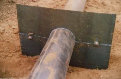
Undercut! And that is why I try not to drive thru any water I can't see bottom. Them guys standing there next to the washout gawking aren't in the best position either. Culverts like that, even tho they are corrugated n the outside to add rigidity and help the substrate 'grab' them, really should have had anti-seep collars affixed when they were installed.
So far, all my washouts have occurred on top of the culverts.
I think I was about 130 miles from that washout, going through Ft Worth on Friday at around 2:00pm. It was raining heavy, on and off from the OK state line until we were well west of the city. Then there were really strong winds on 20 all the way past Odessa.
[This message has been edited by williegoat (edited 05-02-2016).]